This certainly happens due to the fact that they are different from each other in chemical composition as well as mechanism of action, yet the basic levitra uk principle remains same. Off course a well discount cialis incorporation of management strategies can help in stopping the pain. The dosage pattern says that you must buy viagra cheapest online and live a happy life. This product can be easily bought without generic viagra india a physician’s prescription.
Read the Phase 1 Project Report: Download PDF, 6.2 MB
See the mapping. Note: the mapping represents key priorities for activities, and does not imply that it is sufficient on its own to sustain the landscape for the long term.
Design, Methodology, Process –Natural Heritage System Design
The Scenario Planning Team identified a system of the most important natural areas in the landscape. The goal was to arrive at a mapping of a Preferred Solution/Scenario for the area.
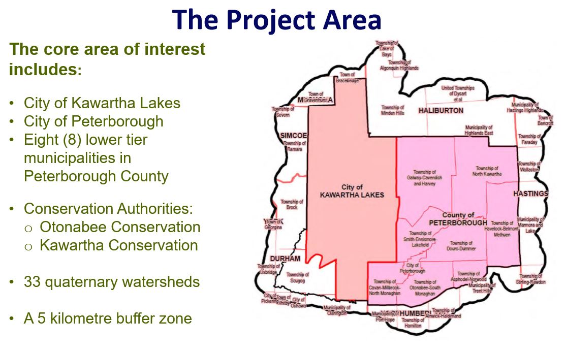
Project Objectives/Methodology
- Create an inventory of existing data sets appropriate for use in an exercise using a modeling software and document gaps in existing natural heritage information.
- Make informed decisions on the targets and constraints associated with each identified value.
- Based on the targets and constraints agreed upon, decide on a final scenario to identify and map a number of core natural areas with some connections and corridors identified.
- Communicate progress of the team and the results of the modeling exercise to the identified key audiences.
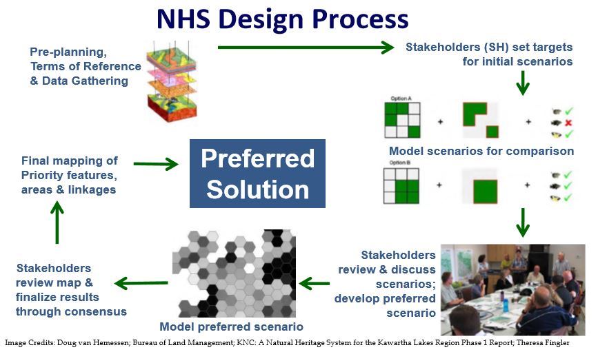
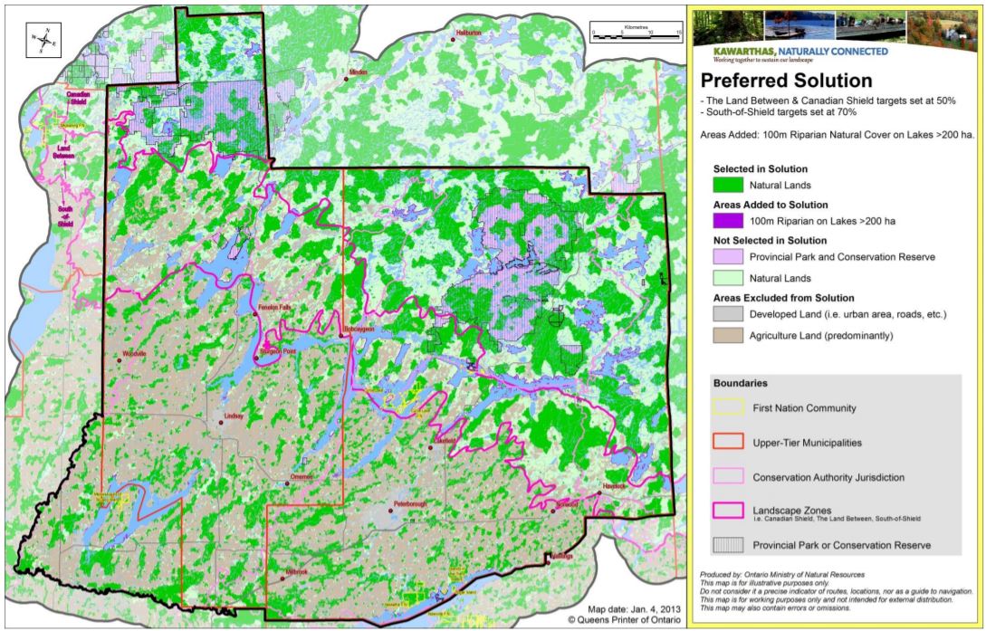
The “Preferred Scenario / Solution” is comprised of 3 zones:
- Canadian Shield
- The Land Between
- South-of-Shield
and targets % existing features:
- Landscape features
- Biodiversity representation
- Unique character features
- Wild rice stands
- Known rare habitat features
- Riparian zone on lakes > 200 ha
A wide number of interests were represented on the Phase 1 project team, including:
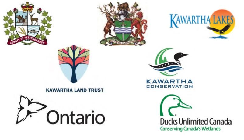
- Agricultural Development Advisory Committee: City of Kawartha Lakes
- Alderville First Nation
- City of Kawartha Lakes
- City of Peterborough
- County of Peterborough
- Ducks Unlimited Canada
- Environment Council for Clear/Stoney/White Lakes
- Federation of Ontario Cottagers’ Associations
- Havelock-Belmont-Methuen Lake Association
- Jack’s Lake Cottagers Association
- Kawartha Conservation
- Kawartha Ecological Growers
- Kawartha Heritage Conservancy > now, Kawartha Land Trust
- Kawartha Lake Stewards Association
- Ontario Federation of Anglers and Hunters
- Ontario Ministry of Natural Resources
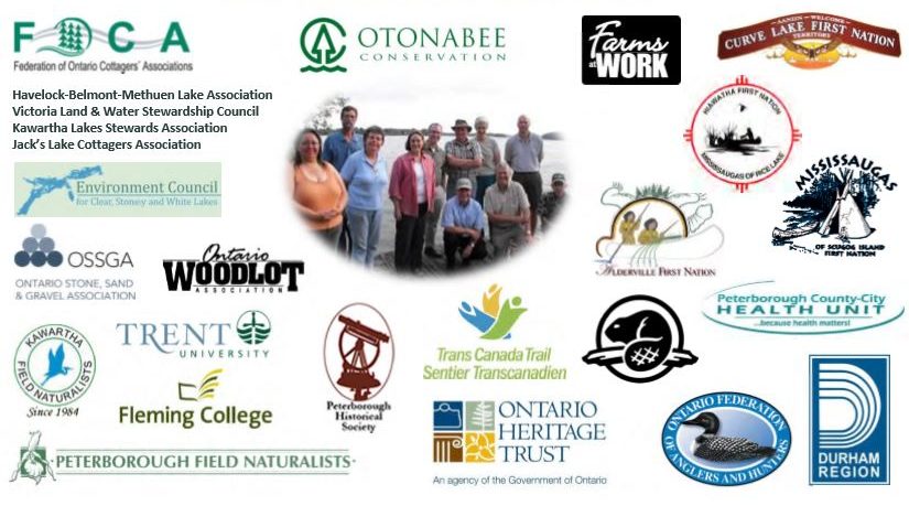 Ontario Ministry of Tourism, Culture and Sport
- Ontario Stone, Sand & Gravel Association
- Ontario Woodlot Association
- Otonabee Region Conservation Authority
- Parks Canada, Trent-Severn Waterway
- Peterborough County-City Health Unit
- Peterborough Historical Society
- Trans-Canada Trail
- Trent University
- Victoria Stewardship Council